
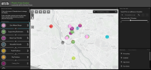
GIS is a framework for gathering, managing and analysing data using maps or 3D scenes
Software firm highlights Exeter 'success story'
The University of Exeter has been chosen as a "customer success story" by a global software company for inventive use of technology called GIS (geographical information system).
GIS is a framework for gathering, managing and analysing data using maps or 3D scenes – and all University of Exeter students and staff have access to GIS software produced by Esri.
The university offers a course in Geography with Applied GIS, and the use of Esri's ArcGIS platform at Exeter is increasing rapidly.
More than 1,300 staff and students – in fields ranging from geography and archaeology to biosciences and mining – are accessing GIS at Exeter, and Esri will now use the teaching at Exeter as an example of best practice for encouraging uptake of GIS as a discipline and accessibility to its software.
"We are delighted that our GIS teaching is being highlighted internationally as a success story by Esri," said Dr Damien Mansell, who leads the Geography with Applied GIS programme.
"This recognizes the hard work of GIS lecturers and support staff, including the IT department, to ensure GIS is available across our campuses.
"It's exciting that our mapping and analytics platform is available to everyone at the university through a 'single sign-on' (SSO) process which allows people to quickly and securely gain full access without having to create and manage additional logins and licenses."
GIS is a technology at the heart of spatial analysis to map things and locations to answer questions, detect patterns, tell stories and make insights that cannot be inferred from spreadsheets and charts.
It is a science and discipline it is own right, which is recognised by the new Geography with Applied GIS programme at Exeter and the success of its graduates.
Uses by Exeter students and staff have ranged from mapping the use of bike parks on campus to optimising data analysis workflows for monitoring the success of crops in Afghanistan, detecting melt patterns of Arctic ice-caps and mapping river evolution and flooding.
One of the major developments widening the adoption of GIS at the University of Exeter was the integration of SSO functionality, which linked the ArcGIS platform with the university's IT system.
David Hein-Griggs, a software specialist in Geography who oversees the University of Exeter’s ArcGIS online web portal, said: “The University of Exeter was the first UK university to adopt the use of Single Sign On with ArcGIS online.
"Prior to this, accounts had to be created manually.
"Due to the success we had using SSO, ESRI pushed for other UK universities to adopt our SSO solution and has now made it a requirement.
"Students who log in for the first time to ArcGIS Online now have immediate access to the vast majority of ESRI’s software, training and web services.”
In 2014, Dr Mansell introduced ArcGIS online into his GIS teaching, allowing students to transform the way they communicated GIS outputs into interactive dashboards, web maps and bespoke web apps.
Previously, students were presenting their data in reports, using static map figures and writing figure captions, similar to a scientific paper.
Now, with the evolution of interactive maps in their toolkit, students can build a powerful visual narrative for their story.
Graduate Rebecca Marsden said: "Studying in the University of Exeter's new Geography with Applied GIS programme has been an invaluable experience for transitioning into a GIS-based career.
"Learning how to utilise GIS in various landscape management applications taught by expert lecturers in the field has provided me with not only the sought-after technical skills to analyse geospatial data but also a great passion for remote sensing and the environment."
Date: 20 August 2020