Access our facilities
Facilities
Our research facilities and equipment span a range of sectors and disciplines and allow us to carry out cutting-edge environmental research. Below are the facilities available to our staff and students that can be used as part of collaborative research projects with businesses.
DroneLab
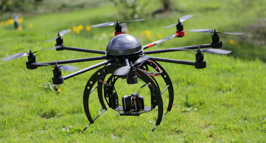
We have a dedicated drone laboratory and a range of systems, including a heavylifting delta wing aircraft, heavy-lifting octocopter, lightweight powered gliders and lightweight multi-rotor aircraft. We combine drone survey flights with expert ground-support using field validation methodologies which we have developed and refined. We have a high accuracy differential GPS to support registration of data and access to a high performance computing cluster with bespoke software for rapid data processing. Find out more about DroneLab.
Scanning Electron Microscope
Details:
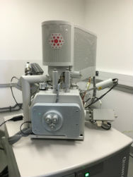
The Quanta 650F is a world leading field emission gun, scanning electron microscope (FEG-SEM) capable of imaging materials to a maximum of 10 nanometres resolution (approx.). The SEM is equipped with two Bruker series 6, 30 mm diameter SDD EDS detectors allowing rapid elemental X-ray analysis and mapping. In addition, it has automated mineralogical capability in the form of QEMSCAN®. Typical uses of the instrument include the imaging of geological samples to study texture, shape, size and the minerals present, and imaging of materials science samples with chemical analysis via spot and mapping modes. The instrument is primarily for research and R&D projects.
SEM: FEI Quanta 650F.
Imaging modes: SEI (detection 5nm to microns approx.), BEI, plus specialist adaptions.
Vacuum modes: high vacuum, low vacuum, ESEM mode.
Analysis type: imaging, chemical analysis for inorganic material only.
X-ray detection: 6C to 92U (±1% approx. in manual mode).
CL detector: Gatan monochrome.
Sample type: depends on the application, typically solid.
Sample preparation: for the best imagery and analysis, samples need to be prepared and coated (usually with carbon) before being presented to the SEM. For example, thin sections, polished blocks/mounts, SEM stubs, sprinkle/smear mounts, filter papers, metal fragments, or anything that can fit into the chamber and sample holders. However, it is possible to examine unprepared and uncoated samples using low vacuum and ESEM mode, but the image quality and analysis is more limited than high vacuum mode.
Used for:
a) Imaging a sample in the micron to nanometre range.
b). Chemical analysis of a spot or area (map) of a sample. Inorganic samples only.
ESI Beowulf Cluster: Carson
The ESI cluster and its associated components (Beowulf Cluster/Web Server/Database Server/Virtual Machine Server) provide strong computing architecture to support the diverse needs of an interdisciplinary research centre The role of the ESI in investigating environmental changes and the Green Campus ethos of the Penryn campus has moulded the specifications of this cluster. We aimed to achieve the highest possible performance with the least possible environmental impact per unit processing power along with allowing for utmost manageability, scalability and catering to a wide user base.
What are HPC, HTC and Beowulf Clusters?
The term high performance computing (HPC) refers to any computational activity requiring more than a single computer to execute a task. Supercomputers and computer clusters are used to solve advanced computation problems. High-throughput computing (HTC) is a term to describe the use of many computing resources over long periods of time to accomplish a computational task. A Beowulf cluster is a ‘supercomputer’ built from a group of smaller computers; the first Beowulf cluster was constructed in 1994 by NASA
How powerful is the Cluster?
Below is a quick comparison of the overall performance of Carson compared to the average desktop computer in use at the time of purchase:
| Carson | Desktop | Factor | |
|---|---|---|---|
| CPU Cores | 2032 | 2 | 1016 |
| GPU cores | 9984 | - | - |
| RAM (GB) | 9536 | 4 | 2496 |
| Raw Hard Disk (TB) | 300 | 0.5 | 600 |
| Performance (TFLOPs) | ~32 |
At the time of purchase, Carson was believed to be the fastest cluster in the Southwest of England excluding the three clusters run by the Met Office based in Exeter (approx. 465, 390 and 129 TFLOPs).
At the time of purchase, Carson was believed to be the fastest cluster in the Southwest of England excluding the three clusters run by the Met Office based in Exeter (approx. 465, 390 and 129 TFLOPs).
Radars
Vertical-Looking Radar
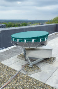
Our Vertical-Looking Radar (VLR) is used to investigate the abundance and behaviour of insects flying at high altitudes (150 m to 1200 m). Such facility allows us to research windborne migrations of highly mobile insects that can often show rapid changes in spatial distribution. The VLR can detect insects as small as 2 mg at the lowest altitude but greater than 15 mg at all altitudes. The returned signal provides information on the mass, body shape and wingbeat frequency of a detected target, enabling its identification. Information interpreted from the returned radar signal about mass, body shape and wingbeat frequency provide opportunity to identify the detected target, and relate this to its speed, direction and alignment. Data generated on such high altitude migrations inform our understanding of biometeorology and spatial population processes, and contribute to the development of appropriate management strategies.
Harmonic Radar
Born out of pioneering collaborative research, led by Prof. Juliet Osborne and Prof Joe Riley, the harmonic radar enables individual tagged low-flying insects to be tracked continuously as they fly over several 100 metres to ~ 1 km. There are only two institutions in the UK and three in the world that currently possess such technology, facilitating research into animal navigation and animal cognition in a field setting. Harmonic radar utilises minute, light-weight reflective tags (or transponders), fitted to an insect’s thorax, that receive an incoming signal and reflect its harmonic. A receiver selectively tuned to the harmonic is able to distinguish a tagged individual from otherwise radar clutter and thus establish a flying insect’s location to a high precision. Juliet’s group is well-known for their work on the foraging and navigational abilities of bees and butterflies, and how these may be influenced by various natural or man-made factors.
Lab Rover
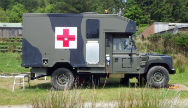
The LabRover is a unique facility providing a flexible and mobile field-laboratory, in support of a range of terrestrial ecology and geography research areas based on the Penryn campus. The LabRover is based on an ex-MOD Land Rover Defender 130 Battlefield Ambulance, incorporating modular units that permit easy conversion for specific needs. Being 4-wheel drive and fitted with a self-rescue winch, it is well suited to remote field situations. It has been effectively used as a radar operation control vehicle in harmonic radar studies of social bee foraging and orientation behaviour, as well as a mobile shelter for observation hives, and associated electronic and AV monitoring equipment, during studies of behaviour in isolated landscapes. It also provides an essential mobile laboratory for collection of field samples where rapid processing and safe storage is key.
Stable Isotope Facility
The Stable Isotope Facility (SIF) houses instruments that are able to measure the natural variation in stable isotopes of carbon, nitrogen, sulphur, oxygen and hydrogen which are present to differing amounts in almost all molecules, these molecules are the building blocks of every organism, rock formation, chemical and structure on this planet and all others, the solar system, the galaxy and the universe.
By measuring these elements and isotopes it means that we can track the transfer of these elements as they progress through the environment. It permits insights into ecology and agriculture by providing information on transfer between predator to prey and uptake of nutrients by plants, it can assist in tracking migrations of species as they pass through different regions such as the migrations of turtles, sharks and butterflies. The technology has the ability to research palaeological shifts in temperature and other parameters of geological interest by analysing fossils. It has been used to analyse archaeological samples of to determine the lifestyles of mummified remains before death. The use of the isotopic information has been crucial in sporting activities to detect doping by athletes such as cyclists eg: Floyd Landis and it is used to also prevent food fraud by it's abilities to detect the origins of food and the addition of modifying agents such as adding cane sugar to honey. There has been extensive use made of isotopes as metabolic tracers to enable greater understanding of nutrition and disease in humans. There is growing interest in the hydrological cycle where it can help track both water flow and also the movement and origin of pollutants. There are techniques to monitor greenhouse gas emissions and identify origins of gases such as carbon dioxide, methane and nitrous oxide.
The SIF is currently involved in a very wide range of research projects, determining the feeding strategies of Buzzards, Foraging in Dormice, the Impact of the Reintroduction of Pine Martens, the transport of organic matter to support deep water shark species, seal foraging behaviour, turtle migrations to feeding sites, palaeoclimate variations in European rocks, elucidating a novel microbial pathway for nitrogen in humans, dietary stress in Australian field crickets, foraging in Icelandic geese, meercat community structure and the transfer of feeding strategies between generations, the impact of differing levels of light pollution on plants and associated animal species. We are beginning to consider the use of isotopes to understand the hydrology of the Cornish mine systems.
SIMRAD
Our SIMRAD system enables us to estimate fish biomass and map the seafloor to improve our knowledge on fish stocks, where they aggregate (and where they don’t). The equipment has a very applied application in that we are using it to understand the value of protected areas (i.e. where human fisheries activity is modified) and as such we can investigate what relieving fishing pressure does to an ecosystem.
We are working at the Wave Hub site on the north coast of Cornwall attempting to establish how fish biomass patterns may change through the development lifetime of a renewable energy development. We are also using the system ad hoc to understand where fish may aggregate in other areas around Cornwall
We are also looking to use the equipment to understand how oil infrastructure influences our seabed and fish stocks – i.e. can you integrate the footprints of oil platforms (and their surrounding waters) in to extant marine protected area networks or are the no-go areas around oil rigs really poor surrogates for protecting marine biodiversity.
Rooms
The ESI’s Richard Trevithick room is an ideal space for hosting meetings and events for collaborative projects with businesses and stakeholders. With videoconferencing, teleconferencing and presentation facilities, the space is perfect for board meetings, workshops and guest speakers. Our Interactive Space and café opens from 9am-3pm on weekdays and is a great site for small business meetings as well as for hosting collaborative events. The campus has a dedicated Events Officer and Hospitality team to cater for events.


