MSc Geographical Information Science
| UCAS code | 1234 |
|---|---|
| Duration | 1 year full time |
| Entry year | 2027 |
| Campus | Streatham Campus |
| Typical offer | 2:2 degree |
|---|---|
Why study a GIS Masters at Exeter?
- Geographical Information Science (GIScience) in application has the potential to change the world. From agriculture, climate change and ecology through to weather, utilities and transportation, there are hundreds of applications of GI Science and a myriad of benefits to society.
- Geospatial data is used to solve problems in all sorts of For example, satellite imagery can be used to observe iceberg formation and understand glacial processes; weather information can be used to help filter claims for insurance companies; traffic flow information can be used to improve ambulance response times; geovisualisations can be used to create 3D views of locations and drone footage can be used to manage forests.
- Join our MSc Geographical Information Science to learn the entire workflow of geospatial data – from data collection, analysis and modelling through to mapping, generating predictions and validating your findings
- Our carefully designed programme means that whether you have a background in geography or are new to it and looking to change paths, you will find the programme challenging and rewarding
- We enable you to develop practical skills such as coding, drone analysis, remote sensing workflows and geo-visualisations, as well as key employability skills such as group work, communication, and presentation
- Our location in the beautiful South West enables us to provide field trips to unique sites such as Dartmoor National Park and engage with partners such as the Environment Agency and Treeconomics
- You can tailor your degree to your career aspirations by undertaking an applied project which can be either research-led or consultancy focused
- You will graduate into the Exeter Geographic Information Systems (GIS) network made up of 300 GIS professionals in diverse roles at various organisations (find out more in the careers section) and be equipped to pursue careers in the spatial information industry, national and local government, consultancies, utilities and research organisations

Top 40 in the world for Geography
QS World University Subject Rankings 2026

Top 15 in the UK for Geography and Environmental Science

6th in the UK for world-leading research in Geography and Environmental Studies
Based on 4* research in the Research Excellence Framework 2021

1st in the UK for Climate Action
Entry requirements for 2027 entry
A 2:2 degree.
An understanding of potential applications of geographic information systems (GIS) is all that is required as students take a core module in their first term covering fundamentals, such as cartographic principles, web maps, responsible mapping, data file management and introduction to coding. This serves as a recap for those with existing knowledge but offers thought provoking challenges through the bespoke content design of this course
Applicants with workplace experience will be considered on an individual basis.
Please also see our guidance on essential documentation required for an initial decision on taught programme applications.
Entry requirements for international students
English language requirements
International students need to show they have the required level of English language to study this course.
The required IELTS test scores for this course fall under Profile B1.
Please visit our English language requirements page to view the required test scores and equivalencies from your country.
The MSc Geographical Information Science provided an incredible insight in the availability and value of geographic information systems (GIS) data and their ability to transform every day information into intuitive visualisations and analysis to better inform decision making processes.
Having no background in Geography prior to my admission, the course content, coupled with the knowledgeable and enthusiastic faculty, provided a well-staged delivery of topics to ensure the building of foundation concepts throughout. This allowed me to easily grasp more complex topics along the way, aided by exceptional academic and pastoral support.
Having attended the course as a mature student on a scholarship from the Royal Air Force, I have since been able to apply this knowledge and skillset to a number of interesting projects. One of these is the development of a federated digital twin environment that provides exact digital replicas of MOD sites, enable more efficient, sustainable use of site assets and enhancing the pace and potency of top-level decision-making processes.
I would entirely recommend this course and the skillsets it provides. I have already been exposed to a wealth of exciting job roles and academic possibilities both during and after the course. The facilities and environment provided at the University of Exeter couldn't have been more conducive to allowing me to successfully navigate my journey back into higher education and provide a wonderful backdrop to the course.
Stephen
MSc Geographical Information Science graduate

Course content and modules
Geographic information systems (GIS) and remote sensing tools are the technologies at the heart of this multi-disciplinary science which is transforming the way data is collected, the research we undertake, the networks we reach, the way we communicate through geo-apps and the decisions that we make as individuals and organisations.
You will empower digital transformation through GIS and discover how it is being applied in a growing sector crossing all industries including business, government, science and leisure.
We will train you in the complete GIS workflows, from data collection to processing, analysis, publication, and dissemination of insights. You will develop skills in applying, investigating, visualising and communicating spatial data and detecting patterns. Alongside this, you will study drone analysis and geo-visualisations, discovering the 3D capabilities and animation in the Esri platform and open source solutions.
Optional modules enable you to gain a more in-depth understanding of applications and data ethics.
Your applied project will either provide an opportunity for you to work with external partners and apply GIS skills in a consultancy project or work with a University of Exeter academic to tackle local or global research goals.
The modules below provide examples of what you can expect to learn on this degree course based on recent academic teaching. The precise modules available to you in future years may vary depending on staff availability and research interests, new topics of study, timetabling and student demand.
Please note that the module information displayed here is subject to change.
150 credits of compulsory modules, 30 credits of optional modules.
You must choose either GEOM185 or GEOM186, you cannot choose both modules
| Code | Module | Credits |
|---|---|---|
| Compulsory 2 | ||
| GIS for Professionals | 15 | |
| Environmental Remote Sensing | 15 | |
| Coding for Spatial Analysis | 15 | |
| Drone Analysis and Geo-Visualisations | 15 | |
| Spatial Data Science | 15 | |
| Open Source GIS | 15 | |
| Compulsory Choice | ||
| Applied Project (Academic) | 60 | |
| Applied Project (Consultancy) | 60 | |
GEO3239: GIS for Professionals
Geographical Information Systems (GIS) provides the ability to analyse data spatially leading to better understanding of what is happening in different places informing decisions across all sectors of research, business, government, education, entertainment and leisure. This module develops your understanding of GIS by using spatial data to discover solutions to real world applications. You will not just be developing GIS skills but also discovering the numerous opportunities for a career in GIS. Discovery and learning will develop from click and point operations, to developing workflows, models, scripting GIS and an understanding of automation.
This is a core module for all incoming students on the GIS MSc.
Learning in this module is largely through directed and supported enquiry-led computer exercises. Exercises will be developed from research expertise in Geography as well as those developed in collaboration with external partners including Esri from real-world applications. Esri is the world leading GIS provider in industry and business. You will have access to the latest software and run computer exercises in ArcPro, ArcGIS online, Q-GIS and python environments. Delivered content will introduce key concepts and techniques and will develop GIS skills and management such as:
- Cartography.
- Web GIS: Responsible mapping
- Introduction to GIS automation
- Decision making with GIS: Applications
You will also develop skills appropriate for careers in GIS:
- Data management.
- Data sharing, publishing and collaboration.
- Data visualisation.
- Management of a web GIS including access, permissions and data sensitivity.
This module aims not just to develop your GIS skills and opportunities for employment, but also attributes required in the professional workplace including:
GEOM180: Environmental Remote Sensing
In this module, you will learn about how different remote sensing approaches are used to quantify environmental changes, and how these observations can be used to help address global challenges such as the UN Sustainable Development Goals. Through lectures you will develop your understanding of the physical principles behind a range of remote sensing approaches, as well as the strengths and weaknesses of these approaches for a range of applications in environmental science. You will then put this understanding into practice during computer-based coding and data analysis tasks. Learning will be consolidated and extended during regular discussion seminars.
You will have the opportunity to use knowledge and skills acquired during this module in GEOM183 Spatial Data Science.
The overall aims of this module are to:
GEOM181: Coding for Spatial Analysis
Coding for Spatial Analysis module description:
Geospatial Analysts (hereafter referred to as Analysts) investigate the Earth’s physical processes, including landforms, climate, ecosystems and human-environment interactions.
Spatial analysis relies on tools and techniques to process, analyse and visualise geospatial data. Proficiency in coding languages (Python and R), operating systems (Linux), geospatial libraries (GDAL) and Application Programming Interfaces (APIs) equip Analysts with critical skills to address complex research questions and significantly enhances their employability in a competitive job market. These technical skills are indispensable, particularly in terms of career opportunities.
GEOM182: Drone Analysis and Geo-Visualisations
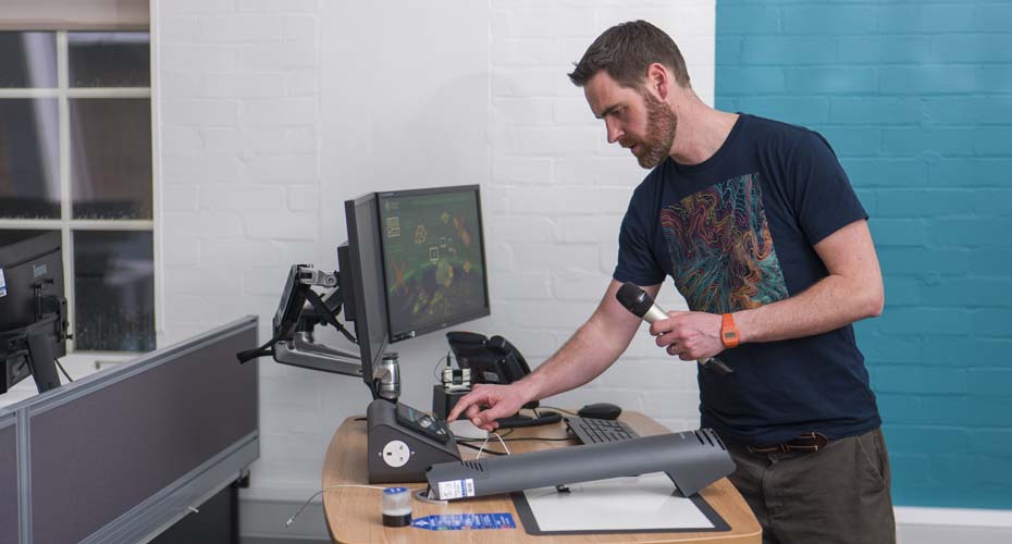
Discover how the geospatial and technical revolutions have led to new and innovative ways to engage and publish spatial data. Learn the principles of photogrammetry structure from Motion (SFM) and apply them with your own data set collected from The University of Exeter remotely piloted air systems also known as drones. As part of this module you will discover the complete workflow from designing your own flight patterns, collecting the data, analysis and preparing final outputs. Discover 3D capabilities in and create immersive learning environments in The University of Exeter's bespoke learning and assessment tool for IVE's (interactive virtual environments).
Due to the costs associated with field work and drone training, students not on the GIS MSc will need to seek DESE approval to take this module.
GEOM183: Spatial Data Science
Module Description:
Spatial data science (SDS) adds multidimensional geographical data including evolving timescales and place-based context to the growing field of data science. Combining spatial data for important geographical problems with methods and tools from data science, GEOM183 provides powerful methods to enhance analytics, visualisation, and problem solving.
Building on GIS, coding, and remote sensing skills (e.g., learned in Term 1), discover advanced spatial approaches that incorporate geography into GIS-based computation. This module will provide deeper understanding how to incorporate spatial characteristics using both standard SDS approaches for exploring globally available datasets as well as learning specialist techniques to turn the environmental data into useful understanding (with examples drawn from Exeter research). Approaches you will use include analysing multidimensional data to discover trends, evaluating causal relationships, and quantifying change. You will also undertake local fieldwork to understand land classification techniques and integration of real-time sensor networks into analysis of landscape system dynamics (building on concepts presented in an optional Term 1 module, GEO3223).
Module Aims:
GEOM184: Open Source GIS
Discover the fast-growing market of GIS beyond commercial and proprietary GIS, enabling individuals, small and medium enterprises to enhance their work through communicating and engaging with spatial data. Become proficient with open-source platforms such as QGIS made available through the Open Source Geospatial Foundation. Discover Google Earth Engine and R as powerful geospatial tools enabling non-GIS specialists to create online interactive maps and share them with the wider world. Students will be exposed to open-source data sites and version control, and will learn the importance of collaboration and workflow management.
This module aims to give an overview and critical knowledge of how open-source GIS can be utilised to conduct a variety of GIS applications. The module has the following broad aims:
- To introduce you to principles and capabilities of open-source GIS software, and how it can be used for a range of GIS tasks.
- To equip you with knowledge and skills to use open-source GIS software for data management, manipulation and spatial analysis.
- To support you with the ability to critically evaluate the results obtained from open-source GIS software, and to make valid conclusions and suggestions for further research.
The module includes a combination of extensive practicals and group work that aim to develop the following skills:
GEOM185: Applied Project (Academic)
Applying academic exploration to University of Exeter research. Students will be assigned a lead academic to be supervised by them in a project focussing on research. Research groups you can work with in Geography include Crysophere, Coastal and River Dynamics, Environment & Sustainability, Cultural and Historical Geographies, Space, Politics and Society, Earth System Scienceas well as centres and institutes including the GSI and CREWW.
Through the application of GIS to explore real-world challenges you will undertake your own independent, high quality and substantial research into a subject of your choice.
By drawing on skills and knowledge taught in the programme and with appropriate guidance and supervision, you will be responsible for designing, planning and implementing the study, as well as analysing the data and writing it up.
You will define your project over Terms 1 and 2 via seminars and workshops. By the start of the summer term you will have a project proposal agreed and an academic supervisor assigned.
Applying academic exploration to University of Exeter research offers you the opportunity to conduct original scientific research.
GEOM186: Applied Project (Consultancy)
In this module you will apply and develop Geographical Information Science through the revolution of spatial analysis, mapping and geo-technologies. Through the application of GIS to explore real-world challenges you will undertake your own independent, high quality and substantial research into a project that meets the requirements of an external partner in a consultancy style role. This module offers you the opportunity to work and build links with the types of organisations you will be seeking employment with on successful completion of the programme.
By drawing on skills and knowledge taught in the programme and with appropriate guidance and supervision, you will be responsible for designing, planning and implementing the study, as well as analysing the data and writing it up.
You will identify a project partner and define your project over Terms 1 and 2 with support in seminars and workshops. By the start of the summer term you will have a project proposal agreed and an project partner assigned.
Applying exploration to real-world challenges via UoE external partners such as ALCIS, BRC, Met Office, or Esri's customers offers the opportunity to challenge you to propose solutions to contemporary problems.
| Code | Module | Credits |
|---|---|---|
| Optional 1 | ||
| Landscape Archaeology: Understanding the Historic Environment | 15 | |
| Digital Mapping and Survey | 15 | |
| Green Planet | 15 | |
| Sustainability in Practice (Work Placement) | 15 | |
| Climate Change Science and Solutions | 15 | |
| Quantitative Methods and AI for Environmental Challenges | 15 | |
| Data Governance and Ethics | 15 | |
ARCM225: Landscape Archaeology: Understanding the Historic Environment
You will examine on this module sources, methods, and themes in the archaeological study of landscapes (e.g. settlement patterns and hierarchies, communication routes, field-systems and other land-uses, building remains, multi-phase sites, continuities and discontinuities in landscapes), and explore key themes in the evolution of landscapes in a variety of locations, including Britain and continental Europe. Although there are no pre-requisite modules, you will need to have a basic understanding of the techniques of archaeology (equivalent to undergraduate introductory level modules). On completion of the module, you will understand the major sources and techniques used in the archaeological study of landscapes and you will be able to critically assess which methods are appropriate for studying particular landscapes.
ENGM036: Digital Mapping and Survey
Understanding the location in which you intend to build, and the opportunities and constraints that offers, is extremely important to the Civil Engineer. This module will allow you to get to grips with topographical survey methods such as LIDAR and drones, as well as underground investigative techniques, such as ground penetrating radar. You will study topography, the earth’s upper strata and map types, so that you have a strong understating of environment in which you aim to operate. And for the areas that you cannot get sufficient information, you will learn about the best techniques to find out more.
The module aims to give you a clear understanding of the strengths and weaknesses of the investigative tools at your disposal, and how you might employ them to assist you in making better decisions about your project. And it will equip you with the ability to use digital tools to manage and analyse the significant amount of data produced by surveys.
GEOM149: Green Planet
The Green Planet module will connect you with the land, the greenscapes that provide our home, our food, filter our water and draw down carbon from the atmosphere. The aim being to provide you with an informed, solutions-focussed understanding of the value held within our planets land-based ecosystems, that are literally a green economy. The module will be presented by an array of experts in the field; both from academia, policy, land-management and industry, linking research-based understanding of nature with practical application. The course will cover the basics from the definition of natural ecosystems, why biodiversity matters to the understanding of ecological baselines and biodiversity in the Anthropocene. But further, it will provide you with the opportunity to develop your understanding of the challenges for conservation and how these interact with zero carbon agendas, how we can value and quantify the natural capital held in ecosystems and the services they provide through considering sustainable land-management for food production. If you want to see the value of our natural land-based environment and hone your thinking towards working to provide sustainable land management practices, then this is the module for you.
GEOM433: Sustainability in Practice (Work Placement)
More than ever before business and enterprise need to engage with sustainability in both their vision and operation. This module will help students to better understand some of the practical aspects of working within a range of workplaces that benefit from a knowledge of global sustainability solutions. The core of the module is a work placement, which you will secure with ideas from guest speakers who are actively working within a range of relevant sustainability roles, and access to bespoke careers advice. Within your placement, you will have the opportunity to either develop an original project, or to support ongoing work that will articulate sustainability as a core value.
This module aims to enable students who have an interest in working in the environment and sustainability sector to develop transferable skills, through work experience with a relevant organisation, an online skills development programme, and guest speakers from a range of sustainability focussed workplaces. You will have the opportunity to gain experience in the sector and to develop a range of transferable career skills.
The module will:
MTHM054: Climate Change Science and Solutions
This module will expose you to some of the most vibrant frontiers in the science of anthropogenic climate change. It will provide an overview of the natural science underlying projections of future climate change, enabling you to distinguish between what is known with high-certainty from aspects that remain uncertain. These latter ‘Frontiers in Climate Change Science’ will be introduced by a number of international experts from the University and other renowned research institutions (such as the nearby Met Office-Hadey Centre). Though natural science led, the module is interdisciplinary with a focus on understanding the climate change problem as part of the wider sustainability agenda.
The module will equip you with an understanding of the science that underpins projections of anthropogenic climate change, and separate what is well known from what remains unknown. It will help you to understand the frontiers of climate change science, through guest lectures by international experts (from the university, the Met Office and other centres), and through student-led discussions. There will be opportunities for peer-to-peer as well as independent learning, and expectations for you to engage in debate and discussion during module sessions. As part of the module assessment, you will work in interdisciplinary groups to explain a proposed climate change solution through a group presentation.
MTHM065: Quantitative Methods and AI for Environmental Challenges
This module provides a comprehensive introduction to quantitative approaches for understanding and addressing environmental challenges. You will learn to apply statistical analysis, spatial modelling, and other advanced quantitative techniques to environmental datasets. Using real-world case studies, you will explore issues such as climate change, air pollution, biodiversity loss, and extreme weather events.
The module emphasises developing practical skills to analyse and interpret data, draw meaningful conclusions, and support evidence-based decision-making.
Content is regularly updated to reflect the latest research and methodological advances, ensuring you gain cutting-edge skills relevant to contemporary environmental problems.
SOCM033: Data Governance and Ethics
Data science, machine learning, artificial intelligence and 'big data' have become central to every aspect of social life. How can these complex and powerful technologies best be managed and governed for the benefit of society now and in the future? In this module you will: (1) identify some of the main risks and ethical/legal challenges involved in the widespread automation and digitalisation of services characterising 21st century life (for example, the clash between individual desire for privacy, frameworks for data ownership and the institutional commodification of personal data); (2) examine whether and how such concerns can be handled; and (3) discuss the responsibilities of data scientists and other producers of technologies for data analysis towards their proper use.
The MSc in Geographical Information Science was the starting point of a career change for me. The enthusiasm of the professors and the wide range of applications demonstrated in the programme cemented my desire to go into GIS.
I use the skills I gained on a daily basis in my new career as a GIS Consultant at Esri UK. I wouldn't have been able to succeed in my current job without the depth and range of knowledge I gained at Exeter, or without the support of the professors and my fellow students during the application process.
Jenny
MSc Geographical Information Science graduate

Fees
UK fees per year:
£14,300 full-time
International fees per year:
£31,300 full-time
Scholarships
The University of Exeter offers a wide range of scholarships to support your education, with £8 million available for international students applying to study with us in the 2027/28 academic year, including our prestigious Exeter Excellence Scholarships. We also provide awards for sport, music and other achievements, as well as regional and partner scholarships with organisations such as Chevening, the Commonwealth Scholarship Commission and the British Council. For more information on scholarships and other financial support, please visit our scholarships and bursaries page.
University of Exeter Alumni Scholarship
We are pleased to offer the University of Exeter Alumni Scholarship, a scholarship for University of Exeter alumni beginning a standalone postgraduate programme in 2027/28 with us a scholarship worth 20% of the cost of your first year tuition fees.
Terms and conditions, including deadlines, apply.
Teaching and research
How will I learn?
Most learning on core modules takes place through hands-on practicals. In addition, concepts are introduced through lectures, pre-recorded presentations you can access at your own pace and guided study such as reading, podcasts and departmental seminars. Experiential learning takes place in the field, where you will use high precision location information hardware or remote piloted air systems (drones). Seminars and workshops reinforce your learning and include the opportunity to ask questions as well as take part in scientific debate. We support your career development with speakers from industry, including businesses in the GIS sector who are usually alumni of the course.
Field work is applied to research or consultancy project aims and previously included a field course to a research site on Dartmoor National Park, introducing students to Natural Flood Management and River Restoration practices including techniques to monitor large wood characteristics and movement in rivers. Other field work has included flying drones to produce 3D models of infrastructure or agricultural analysis.
Assessment
The majority of assessment is through coursework which takes various formats depending on the learning outcomes. This may include story maps (read an example story map), recorded presentations (watch an example of a recorded presentation), informative posters, reports, and a 12,000 word dissertation.
Facilities
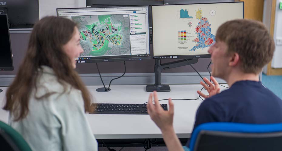
The majority of your hands-on learning and independent assessment work will be completed in our modern, spacious, specially designed Geographical Information Science computer suite. The computer suite is equipped with high powered computers each with dual monitors and is perfect for collaborative or independent work and facilitates effective teaching.
Research
Students have the opportunity to work with research groups in the Geography department such as Cryosphere, Coastal and River dynamics, Environment and Sustainability, Cultural and Historical Geographies, Space, Politics and Society, Earth System Sciences, as well as centres and institutes including researchers from the Centre for Resilience, Environment, Water and Waste (CREWW) and Global Systems Institute (GSI).



Careers
Employer-valued skills this course develops
You will develop a range of technical skills and an ability to apply them in highly sought after areas, such as spatial data science, remote sensing, WebGIS, open source solutions and geo-visualisations. Alongside this we support you to develop transferable skills such as group work, communication and presentation skills.
During the design of this programme, we worked closely with Esri, the world’s leading GIS software provider, to ensure you gain the skills and knowledge required in an applied setting.
Career paths
You will develop a diverse and sought-after portfolio of skills that will lead to careers in the geo-spatial information industry, national and local government, consultancies, utilities, and research organisations. The skills developed will be internationally recognised by employers across industry, educational communities, and scientific institutions worldwide.
GIScience graduates have pursued careers in a variety of roles such as:
- geospatial analyst
- remote sensing scientist
- GIS consultant
- GIS manager
- GIS technician
- data management analyst
- environmental policy associate
- transport planner
- energy systems officer
- campaign data analyst
- geospatial ecology consultant
- biodiversity consultant
- ecological mapping consultant
- national landscape manager
- real estate sustainability manager
- risk modeller
- product engineer
- graduate trainee
- PhD student
Roles such as these could be in a variety of organisations, including (but not limited to):
- the UK Hydrographic Office
- the Environment Agency
- the Met Office
- the NHS
- Esri
- Pegasus Group
- Jacobs
- Arup
- Ordnance Survey
- AECOM
- Entran
- Geollect
- Alcis
Careers services
Our careers teams at the Career Zone can help guide you through a wealth of information to match your skills and interests to a career that will suit you. Our staff work with regional, national and international employers to develop new work placement, project and graduate opportunities.
Find out more about studying at Exeter








Sign-up for more information about studying with us
If you're thinking about studying MSc Geographical Information Science (GIS) with us, signing up to our emails is the best way to discover if we’re the right university for you.