Groundwater Infiltration Risk Mapping
Infiltration adds additional stress to the wastewater network, requiring the transport and treatment of additional water. Not only does this put unnecessary stress on our network, but it also increases the likelihood of Storm Overflow (SO) spills as infiltration reduces the capacity for stormwater in the network.
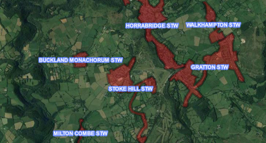
This project aims to generate a risk map for a pilot study in the SWW sewer network, highlighting with a RAG (Red, Amber, Green) rating for areas most prone to ground water infiltration and enabling SWW operations staff to proactively target site investigations. By cross referencing this new map with areas of high CSO spill and pollution events, it is envisaged that works targeted around infiltration will contribute to a reduction in these events.
A 12-monthpost-doctoral research project, this project will result in a full infiltration risk map will be generated for a pilot case study in the SWW network. This will involve building, calibrating, and demonstrating the method on a trial sub-catchment. Having identified a risk map for groundwater infiltration for the pilot case study in the SWW network, it’s anticipated that follow-on projects would extend the work to the entire SWW networkand identify novel and effective approaches to eliminate infiltration. These would go above the current commercial solutions and look to improve efficiency beyond pipe lining/replacement.
Project Team
- Dr James Webber, Lecturer in Water Systems Engineering
- Prof Akbar Javadi, Professor of Geotechnical Engineering
- Dr Nejat Zeydalinejad, Postdoctoral Research Fellow
- Mark Jacob, Senior Asset Manager, South West Water
Professor Javadi and Dr Webber are members of the prestigious Centre for Water Systems, based at the University of Exeter.
Funded by
- South West Water
- University of Exeter