MSci Environmental Geoscience
Please note: This page is for 2026 entry. Click here for 2027 entry.
| UCAS code | F757 |
|---|---|
| Duration | 4 years |
| Entry year | 2026 |
| Campus | Penryn Campus |
| Typical offer | |
|---|---|
|
A-Level: BBC |
Why study MSci Environmental Geoscience at Exeter?
- Designed to equip you with an advanced understanding of the geology, chemistry and physics of the Earth and to tackle global environmental challenges
- Gain technical experience through 70 days of fieldwork, as well as laboratory classes, optional industry placement and a major final-year research project
- Study in Cornwall at Exeter’s Penryn Campus and gain access to world-class geoscience case studies on your doorstep
- Taught by the Camborne School of Mines, a combined geoscience and mining department with an international reputation for research-inspired teaching
- Excellent industrial links ensure that the skills gained will be highly valued by employers. Recent partners include: Rio Tinto, British Geological Survey, European Space Agency and CL:AIRE.

6th in the UK for Geology
The Times and The Sunday Times Good University Guide 2026 and the Complete University Guide 2026
Top 10 in the UK for Earth and Marine Sciences
8th in The Guardian University Guide 2026

Top 50 in the world for Geology
QS World University Subject Rankings 2025

Top 20 in the world for Earth Sciences
18th in the 2025 Global Ranking of Academic Subjects (GRAS) or Shanghai Rankings
Our programmes are accredited by The Geological Society, which is the first step on the ladder to Chartered Geologist status after graduation.
Entry requirements (typical offer)
| Qualification | Typical offer | Required subjects |
|---|---|---|
| A-Level | ABB | GCE A-Level in two science subjects* (see below) at grade B or A-Level Geology at grade B. |
| IB | 32/655 | Two science subjects at HL5 or Geology at HL5 |
| BTEC | DDM | Applicants studying one of the following subjects in the BTEC Extended Diploma, BTEC Diploma or BTEC Extended Certificate will be considered without the specific GCE A-Level subject requirements: Applied Science, Engineering |
| GCSE | C or 4 |
English Language and Mathematics Applicants who have achieved GCSE Maths one grade below the specified requirement will be considered. These applicants may be invited to complete the Maths Transition Course and receive a conditional offer on the basis of successful course completion. |
| Access to HE | 24 L3 credits at Distinction Grade and 21 L3 credits at Merit Grade | 12 L3 credits at Distinction Grade in an acceptable Geology subject area or 24 L3 credits at Distinction Grade in two other acceptable Science subject area |
| T-Level | Distinction | T-level Design, surveying and planning for construction only |
| Contextual Offer | A-Level: BBC |
Specific subject requirements must still be achieved where stated above. Find out more about contextual offers. |
| Other accepted qualifications | ||
| English language requirements |
International students need to show they have the required level of English language to study this course. The required test scores for this course fall under Profile B1. Please visit our English language requirements page to view the required test scores and equivalencies from your country. |
|
NB General Studies is not included in any offer.
Grades advertised on each programme webpage are the typical level at which our offers are made and provide information on any specific subjects an applicant will need to have studied in order to be considered for a place on the programme. However, if we receive a large number of applications for the programme we may not be able to make an offer to all those who are predicted to achieve/have achieved grades which are in line with our typical offer. For more information on how applications are assessed and when decisions are released, please see: After you apply
* Accepted A-Level science subjects include: Biology/Human Biology^; Chemistry; Computing; Design and Technology; Economics; Electronics; Environmental Science; Environmental Studies; Geography; Geology; Maths/Pure Maths/Further Maths^; Physical Education; Physics; Psychology; Science (applied); Statistics.
^If more than one of these is taken they would only count as one 'science' but could count as two A-Levels towards our general requirements.
Course content
During your first year, which is shared with all Geology students, you will gain a solid foundation in geology and the geosciences. You will undertake nine one-day field classes to iconic locations across Cornwall during terms 1 and 2, and attend a one-week residential field class in Pembrokeshire during early May.
In Year 2, you will further develop core geological skills as well as your ability to collect and analyse geological data. Fieldwork includes seven one-day field classes, a residential field course in Devon and Dorset, and training in geological mapping on the Isle of Skye.
A key aspect of year three teaching is its flexibility: in addition to the core modules you get to tailor your geological development to the topics which interest you most. The optional modules you’ll be choosing from cover a selection of continually-evolving subjects tackling a variety of global environmental challenges.
The Environmental Geoscience Overseas Fieldclass provides an opportunity to put into practice your knowledge and field-based skills in environmental geoscience, and includes a residential field course typically cycling between Spain and Cyprus.
During year four you will undertake an extensive research project on a contemporary topic of your choice, working at the forefront of science in collaboration with one of our world-class research groups. Your final year will also include an overseas field trip as well as a module in research frontiers that will introduce you to the cutting edge of geosciences research.
You may notice changes to some of our modules over the coming months. This is because we are making space for the following:
- Minors: Future Skills Pathways - Alongside your main degree you may be eligible (depending on your course) to choose modules from another subject to broaden your skills and interests.
- Skills to Thrive built into every degree - Essential skills for your future, including communication, problem-solving, teamwork and digital confidence.
- Increased innovation and wellbeing - More room for creative learning, real-world projects and a healthier study rhythm.
The modules below provide examples of what you can expect to learn on this degree course based on recent academic teaching. The precise modules available to you in future years may vary depending on staff availability and research interests, new topics of study, timetabling and student demand.
Please note that the module information displayed here is subject to change.
120 credits of compulsory modules
Compulsory modules
| Code | Module | Credits |
|---|---|---|
| Compulsory 1 | ||
| Earth System Science | 15 | |
| Earth and Environmental Chemistry | 15 | |
| Field Geology and Geological Maps | 30 | |
| Quantitative Methods for Geoscientists | 15 | |
| Dynamic Planet | 15 | |
| Crystallography, Mineralogy and Gemstones | 15 | |
| Earth History and Palaeontology | 15 | |
| CSM Professionalism Year 1 | 0 | |
CGE1405B: Earth System Science
The Earth consists of a series of interacting natural systems (lithosphere, hydrosphere, cryosphere, biosphere, atmosphere). The interactions between these systems, called feedbacks, are central to analysing the functioning of major aspects of the Earth, such as climate, sea level and biotic evolution. This way of looking at our world is also critical in analysing the human impact on the Earth system and identifying management strategies to mitigate, remediate or predict geological and environmental hazards and impacts, and in identifying resources. This module is therefore about connectedness and the development of an approach to understanding the Earth that emphasises the connections between the components rather than the components themselves. This module requires no prior skills or experience and is particularly suitable for interdisciplinary pathways.
This module aims to:
- Explore our understanding of Earth origins, the evolution of the solar system, of the ocean, the biosphere and the atmosphere.
- Introduce natural systems theory.
- Identify the Earth’s component natural systems and the Earth’s climate system, its forcings and feedbacks.
- Describe plate tectonics and the role of the internal system in determining or controlling rock formation, the sedimentary cycle, the carbon cycle, Earth surface landforms (geomorphology), oceanic gateways and barriers, biotic evolution.
- Analyse orbital and gravitational controls on the Earth: tides, days, seasons, years.
- Explore the influence of tides on the timing and rate of Earth-moon separation.
- Describe solar variability and its impact on Earth climate.
- Describe the Earth’s radiation balance, atmospheric and oceanic circulation and their role in redistributing heat around the Earth.
- Analyse interactions between the hydrosphere and the cryosphere.
- Identify and describe major biogeochemical cycles, in particular the carbon cycle.
- Explore the causes of major climatic changes through geological time.
- Discuss the evolution of hominids and the interactions of humanity with the Earth system.t
The module will involve a fieldwork component involving an investigation of evidence for sea-level change on the Cornish coastline.
This module will help you to develop and extend your awareness of the importance of taught and learnt skills in strengthening employability potential, especially through the application of critical analytical skills (review of scientific literature, simple calculations) to a range of contemporary global challenges, notably climate change and geoengineering. More generally, through attending the fieldwork and weekly lectures, alongside your own independent learning, you will develop the following academic and professional skills:
- fundamental problem solving (linking theory to practice with academic guidance), collaboration (learning about the views and values of others), and audience awareness (presenting ideas effectively, persuading others of the importance and relevance of your views, responding positively and effectively to questions).
The teaching contributions on this module involve elements of research undertaken by staff, such as work on sea-level change (Scourse). Moreover, you are encouraged to undertake enquiry-led learning, specifically through the field component.
CSM1031: Earth and Environmental Chemistry
A sound appreciation of chemistry is relevant for understanding the environment we live in and the challenges we face. This module starts with an exploration of atomic structure, highlighting how atoms are classified in the Periodic Table of Elements and linking this to fundamental concepts in chemistry, including thermodynamics, kinetics, pH and redox. The distribution of chemicals in natural systems is addressed, emphasising the role and types of chemical reactions in different environments and methods for their detection and analytical characterisation. Aims of the module:
- To gain an understanding of atomic structure;
- To gain an understanding of atoms in materials;
- To gain an understanding of chemical reactions;
- To gain an understanding of chemical analysis;
- To gain an understanding of fundamental principles of thermodynamics;
- To gain an understanding of chemical transformations in aqueous environments;
- To gain an understanding of chemical laboratory and analytical practice;
- To gain an understanding of the major mechanisms which govern the mobility, fate and remediation of environmental chemical pollutants
CSM1036: Field Geology and Geological Maps
Welcome to the module CSM1036 Field Geology and Geological Maps. We pride ourselves on delivering a robust programme of field-based training throughout your degree, enabling you to become competent a field geologist. The ability to identify, record and understand geological data in the field is a fundamental skill for a geologist. Geological maps provide a robust and functional way of presenting geological data allowing greater 3D visualisation of the underlying geology. This enhances interpretations of geological processes and promotes an understanding how focussed data collection can allow hypothesis testing.
This practical-based module focusses on developing your skills with measuring and recording geological observations in the field. It also requires you to utilise skills developed in other modules (CSM1042 Dynamic Planet, CSM1043 Crystallography, Mineralogy and Gemstones, and CSM1044 Earth History and Palaeontology) to start interpreting those observations and focus hypothesis-driven fieldwork. You will also develop skills with geological mapping techniques. This will involve learning how to read and interpret geological maps and visualise geology in 3D. You will also learn how to make a geological map in the field.
CSM1041: Quantitative Methods for Geoscientists
Mathematics and data are at the heart of all science and engineering subjects: we create mathematical models to understand and predict the behaviour of physical systems and we use mathematics to understand data and make precise, quantitative statements about the world. Provided at least a good grade at GCSE level mathematics, this module takes students of all levels of experience or confidence and brings them up to a level required to use mathematics as a tool in their other chosen pathways and modules.
This module aims to:
- provide a solid foundation in key areas of mathematics;
- develop your quantitative reasoning skills in the context of the geosciences;
- develop your appreciation for the role of mathematical modelling and the complexity of mathematical issues in the geosciences.
CSM1042: Dynamic Planet
In lectures you will learn about the origin and internal structure of the Earth, plate tectonics, and the formation, classification and applied significance of minerals, igneous, metamorphic and sedimentary rocks and geological structures. In practicals you will gain hands-on experience of minerals, igneous, metamorphic and sedimentary rocks minerals and rocks and introductory geological maps.
This module is recommended for interdisciplinary pathways.
CSM1043: Crystallography, Mineralogy and Gemstones
Mineralogy is the study of minerals, focusing on their chemical composition, internal crystal structure, and physical properties. Minerals are the fundamental building blocks of the Earth and are essential for identifying rocks and reconstructing the history and conditions under which rocks formed. This module is a core component of Geology, and the ability to describe and identify minerals is a vital skill for all geologists. The skills developed in this course will be used throughout your geology degree.
There are no formal prerequisites for this module, although prior study of introductory geology and chemistry is advantageous. A background in science subjects is beneficial, but the module is also suitable for non-specialist students and those on interdisciplinary pathways.
The module aims to develop your understanding of crystals and common rock-forming minerals, while providing practical experience in recognising minerals in both hand specimens and thin sections.
CSM1044: Earth History and Palaeontology
In this module you will learn why an understanding of stratigraphical and palaeontological principles is central to understanding Earth’s history and the rock record. You will examine the stratigraphic toolbox available to geologists, and how you can apply it to understand geological events in the past, including plate tectonics, climate change, the origin of life on Earth and its evolution through time. You will explore the key fossil groups and how their occurrence in rocks is used to date the geological record, to determine past environmental conditions and to improve our understanding of a range of fascinating time periods including Snowball Earth, mass extinctions and the palaeoecology of ancient animal communities.
The aim of this module is to introduce students to Earth history, the evolution of life on Earth and the principles of stratigraphy, and the application of both stratigraphy and palaeontology in geoscience.
CSM1904: CSM Professionalism Year 1
The aim of the sessions this academic year is to support students' transition to higher education and ensure they understand the support available to them, including how and where to access it. The module builds on the CSM introduction activities during Welcome Week. Sessions will help to foster a sense of academic belonging and community within the broader department. Additional module aims include the acquisition or strengthening of certain key skills that will support their learning in other modules. An introduction to career support and post-graduation possibilities, and the expectations of professional life, will also be provided.
Please note that the module information displayed here is subject to change.
105 credits of compulsory modules, 15 credits of optional modules
Compulsory modules
| Code | Module | Credits |
|---|---|---|
| Compulsory 1 | ||
| Remote Sensing for Environmental Management | 15 | |
| Grand Geoenvironmental Challenges | 15 | |
| Sedimentology and Stratigraphy | 30 | |
| Geological Mapping Techniques | 15 | |
| Geophysics | 15 | |
| Igneous and Metamorphic Geology | 15 | |
| CSM Professionalism Year 2 | 0 | |
CGE2441: Remote Sensing for Environmental Management
Spatial data acquired by satellites, and other flying platforms are increasingly used in decision-making processes about the natural environment. These ‘remotely sensed’ data are fundamentally measurements describing the way that electromagnetic radiation interacts with materials and substances on the Earth’s surface and scientists can use these to create dynamic maps and build models describing Earth system processes through space and time. In this module you will learn about the different ways that we can use remote sensing to monitor the Earth, starting from the ground and working upwards into space where Earth observation satellites are in orbit. In this module we cover the theory and applications of remote sensing drawing on examples from terrestrial and marine applications.
CSM2052: Grand Geoenvironmental Challenges
Grand Geoenvironmental Challenges: will provide you with a physical, chemical and geological understanding of the grand geoenvironmental challenges humankind currently faces, including: climate change, natural hazard, sustainable development, critical need of food/water/mineral, and pollution. A series of introductory lectures will provide you with a mechanistic overview of the occurrence and history of such challenges, along with regard to how they can be overcome/mitigated in the future. You will then produce a verbal presentation and a scientific commentary on a topic of your choice. This module is accessible to any student with a broad Earth sciences background, including those from the Camborne School of Mines and the Centre for Geography and Environmental Science.
The first aim of this module is to develop a holistic and critical understanding of the key geoenvironmental challenges which currently face Humankind. The module brings together subject areas which have been taught in the first and second year of Department of Earth and Environmental Sciences degree programmes, and provides a context for their application: to solve globally relevant challenges within the geosciences. The second aim of this module is to significantly enhance your communication skills, both written and oral, which will be some of the most valued skills after you complete your degree and enter the professional world.
CSM2183: Sedimentology and Stratigraphy
This module will provide the fundamentals of sedimentology, tracing the physical and sedimentary processes from source terrain to sedimentary rock. You will review depositional sedimentary environments and the observations required to infer these from sedimentary successions. Practical work will include optical microscopy and hand specimen description. A central part of the module is a six-day field course to the Wessex Basin of southern England where your ability to describe and interpret sedimentary rocks in the field will be developed. You will also learn about the principal techniques used to date, correlate, and interpret the origin of sedimentary strata. In this module you will learn how fossils, stable isotopes, orbital cycles, rock magnetic properties and geophysical or geochemical logs can be combined to provide an integrated understanding of how we date rocks and how sediments are deposited. In addition, you will be introduced to sedimentary basins and the stratigraphic methods used to reconstruct their depositional histories.
CSM2184: Geological Mapping Techniques
This field based module is made up of three key components that focus on the geology of NW Scotland and the Isle of Skye.
- It combines lecture with a residential field course and allows students to develop their independent mapping and geological interpretation skills.
- Develop an understanding of the regional geology of NW Scotland and Skye; students cover this in a series of lectures ahead of the field course.The module develops core field geology skills, focusing on geological mapping as a fundamental method of collecting and presenting geological data.
- Students spend 8 days mapping on Skye (or similar location in NW Scotland) and produce 3 geological maps of three different locations, and a geological cross-section as part of their assessed field course.
- Students learn mapping techniques, and ArcGIS digitisation to produce professional geological maps.
- Students integrate knowledge of igneous, sedimentary, and metamorphic rocks to interpret geological processes and build coherent geological models.
- Emphasis is placed on safe, professional field practice, teamwork, independence, and building confidence in field-based work.
- This module is key to preparing students for independent mapping and forms part of their professional development.
CSM2190: Geophysics
This module will introduce the fundamental concepts, techniques and results of applied geophysics. If you have ever wondered why graphite deposits can be mistaken for sulphide ores in geophysical surveys, what the best methods are to detect subsurface oil/gas reservoirs on land or at sea, how we can use micro-variations in gravity to delineate cave systems, or what the best geophysical techniques for mineral exploration or volcano monitoring are, this course is for you. The course is recommended as a valuable theoretical background to many subsequent and parallel modules, and will include a science communication project.
The aim of this module is to introduce and demonstrate a variety of geophysical methods that are used to investigate the Earth’s subsurface, with applications for natural resource exploration, monitoring natural hazards, archaeology, and engineering site investigations. Their underpinning physics will be explained, as well as their respective advantages and limitations.
The module develops problem-solving, science communication and team-work abilities and equips students with basic computer programming and computational geoscience skills. The transferable skills and content developed during this module will be applicable for later modules and research projects, as well as industry, with particular relevance for resource exploration (minerals and hydrocarbons) and environmental/engineering site investigations.
CSM2327: Igneous and Metamorphic Geology
This module will provide you with the tools you need to characterise and record the geological materials that form as a result of magmatic and metamorphic processes. You will describe and identify igneous and metamorphic minerals and rocks in hand specimen and thin section. We will place this learning in a tectonic context, to provide some understanding of where and why the rocks form. Field classes will allow students to apply their theoretical learning in a real-world setting.
This module can be suitable for non-specialist students, but some prior knowledge of geology is recommended. This module is compulsory for Geology, Resource and Exploration, Engineering Geology and Geotechnics and Environmental Geoscience students. It provides the foundation for a number of 3rd year modules, including CSM3070 Volcanology.
The module introduces you to igneous and metamorphic products and their plate tectonic context. The module develops the skills that will enable you to describe, identify and classify igneous and metamorphic rocks. You will consider the characteristics of igneous and metamorphic rocks in a mineralogical context.
CSM2904: CSM Professionalism Year 2
This module follows on from the year one CSM1904 module, and will continue to foster a sense of academic belonging and community within the broader department. The content will support students in developing their own research interests and preparing for their dissertation projects. The module will continue to provide career support and guidance, including on developing networking and application skills, and on emphasising professional conduct in the workplace. It will draw on the experience of staff, UoE support services and external visitors. The module will also facilitate the acquisition or strengthening of certain key skills that will support their learning in other modules.
Optional modules
| Code | Module | Credits |
|---|---|---|
| Optional 1 | ||
| Waste and Society | 15 | |
| Physical Ocean Processes | 15 | |
| Geotechnics | 15 | |
CGE2454: Waste and Society
In this module you will develop your skills as a critical thinker and researcher through practical and theoretical consideration of the topic of waste. Moving beyond an understanding of waste as unwanted matter, we will explore the consequences of ‘wasting’: socio-ecological relations producing wasted people, places and substances. We will examine key themes in recent research on waste and consider how this research relates to different conceptual, material and cultural contexts. The module addresses how waste is made and handled (household waste and waste management), how waste circulates through global systems (waste trading, carbon emissions as waste), how wasted places are degraded and reclaimed (environmental remediation and reclamation) and how waste can be reimagined and repurposed (circular economy, repair and reuse).
CGE2457: Physical Ocean Processes
This module will provide core knowledge of the physical processes than govern our oceans. The module will describe and explain both the distribution of different water masses present in the oceans and the movement of water by phenomena such as tides, waves, ocean currents and turbulent mixing. The important role that these phenomena play in both the global climate system and ocean biogeochemistry will be highlighted. Instrumental platforms from which we make physical measurements in the ocean will also be introduced covering both traditional shipboard measurements and remote sensing techniques to state-of-the-art autonomous vehicles and acoustic mapping.
The module introduces physical concepts from a largely descriptive approach, with practical tank experiments/demonstrations to aid understanding and promote inquiry -led learning. The module also includes some computer-lab practical sessions in Matlab to learn how to access and analyse real oceanographic data, and a field trip to collect oceanographic data in the Fal. Regular problem sheets will be provided for students to work through to underpin and embed the concepts covered in the course.
CSM2185: Geotechnics
This module provides a comprehensive introduction to the geotechnical behaviour of rock and soil materials as applied to engineering design. The course begins with the fundamental principles of engineering geological characterization, progressing through core concepts in introductory soil and rock mechanics. You will combine these foundational elements with empirical design methodologies, serving as a basis for more advanced geotechnical engineering modules in the third year.
On this module, you will have a combination of lectures, collaborative group activities, and hands-on practical sessions. Assessment comprises two core components: (1) a technical report based on the analysis and interpretation of site investigation data, and (2) an exam.
Prerequisites:
Successful completion of first-year modules within the CSM programme or possible direct-entry candidates into the second year.
Relevance and Progression:
You will particularly enjoy this module if you are intending to pursue careers in civil engineering, mining and minerals engineering, geotechnical design for surface and subsurface construction, or environmental geosciences. It offers critical insight into the geological and geomechanical factors underpinning engineering design.
Please note that the module information displayed here is subject to change.
105 credits of compulsory modules, 15 credits of optional modules
Compulsory modules
| Code | Module | Credits |
|---|---|---|
| Compulsory 1 | ||
| GIS for Geologists | 15 | |
| Contaminated Land Management and Remediation | 15 | |
| Climate Change: Past and Future | 15 | |
| Hydrogeology | 15 | |
| International Field Class | 15 | |
| Dissertation Project | 30 | |
| CSM Professionalism Year 3 | 0 | |
CSM3047: GIS for Geologists
This module introduces you to the use of Geographical Information Systems (GIS) in geology. This is an essential requirement for accreditation and an important skill for geological employment. The software you will use includes ArcGIS Pro but may introduce other packages. This module trains you to produce high quality cartographic outputs and GIS databases that can be used to inform decision making.
The aim of the module is to provide you with a practical introduction to Geographical Information Systems and Science for use as a Geoscientist. You will build on the introductory GIS skills that you have gained from the CSM2184. This module will develop your ability to use core GIS skills, concepts, and techniques in a range of applied scenarios enabling you to assess, quantify and test the significance of patterns and spatial relationships of environmental and geological features.
Lectures integrate within the Practical sessions which are progressive and build on your skills to increase your independence in problem solving.
CSM3049: Contaminated Land Management and Remediation
This module will provide an overview of the occurrence, behaviour and fate on anthropogenic pollutants in the natural environment along with contemporary methodologies for their remediation. The fundamental properties of soil, groundwater and surface water will be covered along with an overview of the analytical techniques that are currently used to characterise anthropogenic pollutants within such matrices.
This module is suitable for students studying courses in geology, mining, engineering and environmental science. It is recommended for interdisciplinary pathways. No pre-requisite module is required.
The aim of this module is to provide an understanding of the causes, characteristics and hazards related to contaminated land and of the practical approaches to its assessment and remediation. The module is enriched with case studies from the lecturers’ own research experience.
CSM3072: Climate Change: Past and Future
This module will provide a broad introduction to Earth’s climate system, past and present, and will equip you with the tools used to study the geologic record for evidence of past environmental and climatic change. You will learn to interpret and critically evaluate the evidence for a varied range of important past changes in Earth’s climate over the last 66 million years, guided by current internationally important research. You will learn about the importance of oceans in the Earth system, and about how climate and the carbon-cycle interact on a variety of time and spatial scales. You will learn how the Earth’s climate has changed both very slowly over million-year timescales, and occasionally shifted very dramatically over much shorter hundred to thousand year timescales. You will examine the influence of external orbital forcing on the climate and carbon-cycle throughout the Cenozoic. You will learn about the impact of recent human activities on Earth’s climate and about the implications of anthropogenic activities for future climate.
- To provide an introduction to the workings of Earth’s modern climate system (ocean-atmosphere-biosphere-cryosphere) with a particular emphasis on the role of the carbon cycle in regulating climatic change;
- To equip you with knowledge of the tools used by geologists to reconstruct past changes in Earth’s climate;
CSM3152: Hydrogeology
In this module you will learn about the fundamentals of the hydrologic cycle, surface water and groundwater. The module will introduce a wide knowledge base delivered through a traditional mix of lectures and practical classes, along with field, laboratory, and software demonstrations. Application of knowledge to engineering problems will be embedded through weekly problem sheets.
The module introduces key aspects of local and regional hydrogeology. We start by looking at how water fits into the global cycle, followed by process controlling the behaviour of surface water, and how rivers and groundwater interact. The course introduces fundamental hydraulic controls on flow of water through geological media. We look at aspects of porosity, permeability and hydraulic conductivity as properties of geological media and how they vary with length scale. We look at how we can describe and quantify material properties through laboratory tests. This is then re-examined in the context of radial flow to wells, with an emphasis on comparing and evaluating different methods of analysis. How we understand and estimate transmissivity and storage from these tests is explored.
CSM3416: International Field Class
This module provides an opportunity to examine an outstanding area of geology famous for its tectonic, volcanic, sedimentological and/or geological evolution. The destination varies but will typically be Spain, Cyprus, Ireland, Italy, Portugal or Tenerife. Depending on the location, you may learn about: (i) geohazards, including their deposits and monitoring, (ii) geothermal and hydrothermal processes, (iii) sedimentary and climatic processes, (iv) palaoenvironments and depositional settings, (v) tectonic landscape evolution and/or (vi) applied, environmental or georesource aspects of the geosciences, integrating knowledge from across the modules covered during your course.
To participate in this module, you need to have studied year 1 and 2 of BSc/MGeol/MSci Geology, Resource and Exploration Geology, Environmental Geoscience, Engineering Geology and Geotechnics (or equivalent). This module is not suitable for non-specialist students or interdisciplinary pathways.
The aim of this module is to develop an integrated approach to the study of geology in field-based settings. This module brings together subject areas that have been taught during the first, second and third year of the study program. We will investigate the interaction of tectonic, geological and climatic processes, and how these sculpt the world around us. The module aims to develop communication and interpersonal skills that will be essential for a successful future career.
CSM3417: Dissertation Project
The Dissertation Project is principally an independent project, designed to give you the opportunity to put into practice the specific and transferable skills you have developed during your degree to date. It will allow you to demonstrate your ability to devise, organise and undertake independent project work that involves the collection, analysis, interpretation and presentation of primary geological data (or equivalent data from a discipline that overlaps with geology).
The module is undertaken by all undergraduate (BSc and MSci) Geology, Resource and Exploration Geology, and Engineering Geology and Geotechnics students. Project work is carried out in the summer months of Year 2, with data analysis, interpretation, and write-up in Term 1 Year 3 and submission at the start of Term 2 of Year 3.
There are three main pathways you can choose from according to your preference:
CSM3904: CSM Professionalism Year 3
This module follows on from the years one and two (CSM1904 and CSM2904) modules. It will continue to foster a sense of academic belonging and community within the broader department. The main aim of these sessions is to support students during their final year and prepare them for the next stage of their careers. This includes building an understanding of professional accreditation and bodies, and further support with successfully applying for graduate jobs. The concepts covered will complement individual tutorials, which will provide an opportunity for students to reflect, discuss and track their individual journey with their tutors.
Optional modules
| Code | Module | Credits |
|---|---|---|
| Optional 1 | ||
| Energy Resource Geology | 15 | |
| Volcanology | 15 | |
| Politics, Mining and Sustainable Development | 15 | |
| Surveying and Digital Mapping | 15 | |
| Evolution of a Liveable Planet | 15 | |
| Soil Mechanics with Mine Tailings Engineering | 15 | |
CSM3061: Energy Resource Geology
Energy underpins modern society, but the ways we extract, store, and transition between energy sources create major geological, environmental, and societal challenges. This module introduces the geological frameworks used to understand and evaluate energy resources and subsurface energy technologies, spanning conventional and unconventional hydrocarbons, coal, carbon capture and storage (CCS), geothermal systems, and the geological supply of critical raw materials that enable low-carbon technologies. The emphasis is on how stratigraphy, sedimentology, palaeontology, and structural geology are applied to real subsurface problems, and how geoscientists assess uncertainty, risk, and environmental impact in energy decision-making.
CSM3070: Volcanology
Volcanoes are geological powerhouses and an important geohazard. By studying their geological products and physical behaviour, we can not only learn about the engine room of Earth's interior but also how to protect populations threatened by them. To learn how volcano research can be used in this way, this module will look at a variety of volcano-related subjects, ranging from volcano monitoring and volcanic risk reduction, through physical, social and geological volcanology, to how volcanology interacts with climatology, petrology and natural resources. You will participate in lectures, seminars, and practical sessions to teach you about the state-of-the-art theory of volcano science and their practical applications.
Pre-requisites for this module are CSM327 Igneous and Metamorphic Geology. There are no co-requisites. This module may be suitable for non-specialist students or interdisciplinary pathways.
This module aims to introduce and explore the processes that drive volcanic eruptions and their impacts on lives, livelihoods and the environment. You will investigate how volcanoes work, and develop an understanding of the physics of volcanic processes, starting from magma generation and the birth of a volcano, through magma ascent and eruption style, to volcanic hazards, impacts of eruptions and risk mitigation. Social and cultural concerns will also be considered as these drive volcanologists to protect communities at risk.
CSM3409: Politics, Mining and Sustainable Development
This module covers the vital industry issues of corporate social responsibility, social license to operate, stakeholder engagement, health & safety and political & environmental factors that affect mining decisions. The module explores how environmental impact is measured, monitored and controlled, and what sustainability means in the context of mining. It also explores international and local mining legislation, expectations of local people in mining regions, and the long- and short-term impacts of mining on a local and national scale with a particular focus on the social, economic and environmental impacts of mine closure. The module covers the key aspects of health and safety management that future managers, engineers and scientists will need to know and find useful in their future lives and careers.
CSM3415: Surveying and Digital Mapping
This module is intended to build upon your previous introduction to surveying, expanding your capabilities. It is intended that you will focus on the practical aspects of surveying most relevant to the areas of industry that geologists are most likely to be engaged with. The module will balance theory with practical exercises.
The module aims to underpin theoretical knowledge with an understanding of practical applications, with the intention that you will be able to demonstrate capabilities that will enhance your employability. Teaching will be provided by staff with extensive experience of surveying in industry.
CSM3418: Evolution of a Liveable Planet
Earth scientists interpret the geological record using process-based reasoning, linking evidence preserved in rocks, fossils and geochemical archives to physical, chemical and biological processes operating on Earth (and other planets) today. In a world of rapid environmental change, this “present–past” logic is increasingly paired with a “past–future” question: what do deep-time tipping points tell us about the planet’s possible trajectories now and in the future? This module revisits the Principle of Uniformitarianism in its modern sense, not as “everything is slow and steady,” but as a disciplined commitment to testable mechanisms, while recognising that rates, magnitudes and boundary conditions can change dramatically.
CSM3444: Soil Mechanics with Mine Tailings Engineering
The course is designed for undergraduate students in various branches of engineering that are concerned with the engineering and hydrologic behaviour of earth systems, including geohazards, geotechnical engineering, geological engineering, environmental engineering and mining engineering. The module focuses on tailings dams and embankment dams and includes laboratory analysis to determine the key failure mechanisms of fine-grained material such as mine tailings.
This module will introduce you to the analyses often used in the design of embankment gravity, embedded and reinforced soil retaining walls, simple shallow and pile foundations, the assessment of slope stability and slope stabilisation schemes. It will build on the basic concepts of soil mechanics, and provide a basis for geotechnical design of embankment walls used widely in the mining industry.
Prerequisite module: None
- To introduce you to the form of and typical methods of construction for geotechnical structures.
- To provide you with the skills to investigate quantitatively the stability of unreinforced and piled slopes; gravity, embedded and reinforced soil retaining walls; and simple foundations.
- To understand the importance of pore water pressures, and assess the impact of changes in pore water pressure on the stability of geotechnical structures.
- To apply suitable factors to limit state calculations to meet the demands of real life situations.
Please note that the module information displayed here is subject to change.
120 credits of compulsory modules
Compulsory modules
| Code | Module | Credits |
|---|---|---|
| Compulsory 1 | ||
| Year 4 Fieldclass | 15 | |
| Research Project | 75 | |
| Research Frontiers in Earth Science | 30 | |
| CSM Professionalism Year 4 and MSc | 0 | |
CSMM423: Year 4 Fieldclass
This module is an advanced research-led field-based course that provides an opportunity to investigate in-depth an area of geology. The destination varies but will typically be Spain, Cyprus, Italy, Portugal or Tenerife. Depending on the location, you may focus on: (i) geohazards, including their deposits and monitoring, (ii) geothermal and hydrothermal processes, (iii) sedimentary and climatic processes, (iv) palaoenvironments and depositional settings (v) tectonic landscape evolution, and/or (vi) applied, environmental or georesource aspects of the geosciences. You will examine how tectonic, climatic and geological processes interact, how they have influenced and continue to influence environment and society, and encounter examples of how such processes are recorded for research and monitoring purposes.
The aim of this module is to develop the independent field-based research skills of the student so they are comfortable planning and producing original field-based work. The goals that underpin this overall aim and the field course in general relate to the possible themes that will be explored, i.e., (i) geohazards, including their deposits and monitoring, (ii) geothermal and hydrothermal processes, (iii) sedimentary and climatic processes, (iv) palaoenvironments and depositional settings, (v) tectonic landscape evolution, and/or (vi) applied, environmental or georesource aspects of the geosciences.
CSMM439: Research Project
This module content is based on the chosen area of independent research. The project topic can be on any aspect of the syllabus relating to the chosen MSci Programme of study.
To undertake an independent research project associated with any aspect of geology.
CSMM440: Research Frontiers in Earth Science
In this module you will gain an appreciation of how to critically analyse research methods, data collection, balanced argument and weighing of the evidence. This will be achieved through a series of seminars taking a forensic look at emerging and exciting frontiers in the Earth Sciences. You will also learn how to communicate scientific results, as well as critically evaluate presentations by others. The topics will be focused on a wide range of research fields reflecting expertise across the discipline, and will include ore deposits and critical metals, mineral recovery, palaeoclimate and global change in geological time, active earth and mining. This module will build upon the concepts and skills learned during CSM modules spanning years 2–3.
- To provide an overview of new and emerging research areas in the Earth Sciences, relevant to the broad range of research carried out in the Camborne School of Mines.
- To gain an understanding and critical assessment of exciting research methods.
- To understand the process of hypothesis testing, balanced argument and creating theory.
CSMM904: CSM Professionalism Year 4 and MSc
The aim of this module is to support students as they adapt to MSc study and prepare for industry and industry aligned research careers. This includes building an understanding of professional accreditation and bodies, and further support with successfully applying for graduate jobs. Additionally, it will foster a sense of academic belonging and community within the broader department.
Fees
Tuition fees for 2026 entry
UK students: £9,790 per year
International students: £31,200 per year
Scholarships
The University of Exeter offers a wide range of scholarships to support your education, with £7 million available for international students applying to study with us in the 2026/27 academic year, including our prestigious Exeter Excellence Scholarships*. We also provide scholarships for sport, music and other achievements, alongside regional and partner awards such as Chevening, The Beacon Trust and the British Council. Financial support is available for students from disadvantaged backgrounds, lower income households and other under-represented groups to help them access, succeed and progress through higher education.
* Terms and conditions, including deadlines, apply. See our website for details.
Fieldwork
All our Geology degree programmes provide a wealth of practical experience of working in the field at amazing locations across the UK and abroad.
The first year includes a six-day residential field course in Pembrokeshire along with nine one-day field-classes in Cornwall. The second year includes 34 days of fieldwork, in locations that include Cornwall, Devon, Dorset and the Isle of Skye in Scotland. The third year includes a geological field course in Cyprus, Italy or southern Spain.
Fieldwork is assessed through field notebooks, technical reports, and practical field-based assignments.
For more information see our Geology fieldwork page.
Learning and teaching
Learning on campus
Learning and teaching are delivered through a combination of lectures, ‘hands on’ practical classes, seminars, tutorials, field-based teaching, and independent study. Laboratory practical classes will develop your understanding of a range of geoscience topics and help put theory into practice.
On average you will have 18 teaching hours per week and will need to undertake additional independent study (e.g., directed reading, assignments, and project work). You can expect your total workload to average about 40 hours per week during term time.
Our geoscience degrees are also flexible; you can transfer between any of our BSc and MSci geology and geoscience degrees during your first year.
Research-led culture
You will benefit from being taught by experts active in internationally-relevant research. In doing so, you will discuss the very latest ideas, research discoveries and new technologies in seminars and in the field, and you will become actively involved in a research project yourself. All our academic staff are active in internationally-recognised scientific research across a wide range of topics. You will also be taught by leading industry practitioners.
Assessment
Assessment methods vary between modules and may include individual or group reports, presentations, practical write-ups and exams. More innovative assessment techniques are also used, and may include the use of websites, posters, social media, videos, science communication, and dragons-den style presentations. You must pass the first year in order to progress to the second year, but your first-year marks do not count towards your final degree classification.
Support
- Personal Tutor: You will have a Personal Tutor available for advice and support throughout your studies.
- Study skills: Help with essay writing, research skills, time management, presentations and more.
- Modern language courses
- Health, wellbeing and general support
Optional modules outside of this course
Each year, if you have optional modules available, you can take up to 30 credits in a subject outside of your course. This can increase your employability and widen your intellectual horizons.
Minors: Future Skills Pathways
You can study a Future Skills Pathway alongside your main degree by choosing up to 30 credits of modules from a different subject area in your second and final years.
Your future
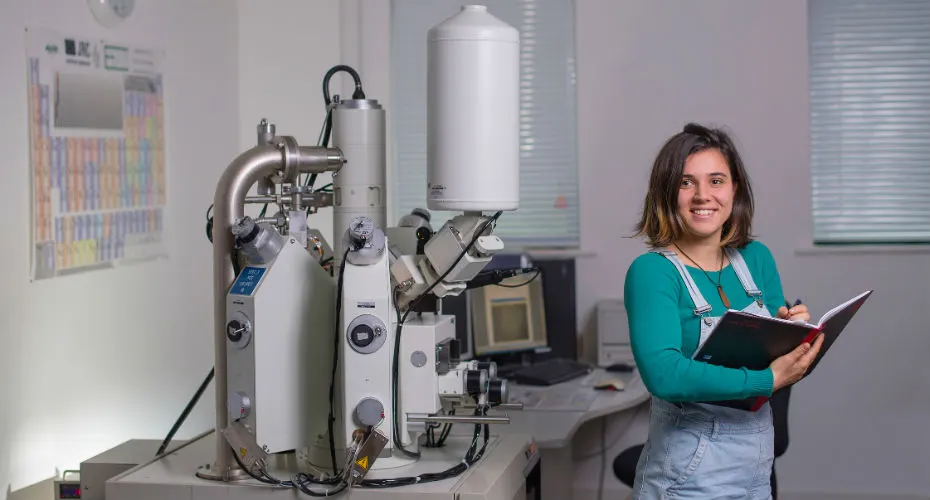
Geologists are required to help the global community deal with a range of environmental problems related to climate, energy, water, air pollution, natural hazards, supply of raw materials, and more.
Geology and geoscience degrees not only prepare you to tackle the world’s biggest environmental challenges, but they also lead to high employment rates and decent salaries, with graduate opportunities in the UK and around the world. The Camborne School of Mines Association and the award-winning University of Exeter Careers Service have the skills and a strong network of alumni to help you find employment.
Employer Visits
We provide regular ‘Pint and Pasty’ employer events throughout term that allow our students to network and meet with potential employers, and learn more about possible career paths.
Career Paths
Our graduates enjoy excellent career opportunities in a range of subjects, including mineral exploration, hydrogeology, geophysics, geotechnics, and environment-related industries. Graduates also go on to roles outside of geology, utilising the array of transferable skills they have developed. Recent graduates work in fields as diverse as the UK civil service, Arup Geotechnics, the National Trust, the Ministry of Defence and Geomarine Ltd.
The broad-based skills acquired during your degree will give you an excellent grounding for a wide variety of careers, not only those related to Geology but also in wider fields. Examples of roles recent graduates are now working as include:
- Chartered Surveyor
- Engineering Project Manager
- Project Engineer
- Engineering Professional
- Estimator, Valuer or Assessor
- Environment Professional
- Financial Accounts
- IT Operations Technician
- Laboratory Technician
- Physical Scientist
Employer-valued skills this course develops
Career opportunities for geologists are limitless. Our programmes provide the essential skills for employment in a modern workplace, including discipline specific skills like Geographical Information Systems (GIS), geological mapping and fieldwork, mineral deposit identification and exploration, scientific programming, and use of technical software, in addition to transferable skills such as problem solving, communication, teamwork, leadership, and quantitative data analysis.
Geologists from the University of Exeter are recognised as being articulate, resourceful and diligent, and claim great job satisfaction and excellent salaries.